 Viseum AI Surveillance Video Monitoring Software
Surveillance training London: accredited operator courses
Our surveillance training London programme certifies the people who will run your national surveillance network. First, we assess the skills your control room already has. Then we build a course around the gap. Finally, we test every operator against measurable performance goals.
Training simulations
Nine simulations show how Viseum systems find, fix and follow what matters. Select a picture to play one in place. Only one plays at a time.
AiRadar and the thermal and optical camera
The Viseum AiRadar finds every object around a site while the thermal and optical camera turns to each one and zooms in. Each sensor has its own role, and the two always work together.
See the Viseum Surveillance Radar page
Read the step-by-step description
A coastal site. The Viseum AiRadar (gold) covers all 360 degrees all the time; the thermal and optical sensors (blue) turn to each person, group, vehicle and ship (at sea only), reach only as far as that target, and zoom in. In the corner by the road, each vehicle, the group of people and the distant convoy of three vehicles are looked at one by one, then the two vehicles together, then the group with the convoy, and finally the whole corner at once. The view on the right names a target once the sensors are halfway through zooming in.
Following one person through standard and Viseum IMC cameras
A Viseum IMC camera picks one person out of a crowd and follows them from camera to camera, beside a fixed standard camera that cannot.
See the Viseum Face Recognition Software page
Read the step-by-step description
Cameras 1 and 3 are standard cameras with a fixed view: each sees only what is inside its cone, narrow close to the camera and wide across the far sidewalk. Cameras 2 and 4 are Viseum IMC cameras: each sees all round, and zooms in on one person at a time, the narrowed view drawn on the street, following them until a usable face is captured. Everyone who walks into a camera's view is boxed in the street view, appears in that camera's view below, and is profiled straight away in the panel on the right, so the three always agree; when several people are in view the panel cycles through them. Find: camera 1 picks the suspect in the red jacket out of the crowd and builds a profile of clothing, height, build, hair, bag and walk. Between cameras the suspect is out of sight and the profile is held. Faces are captured whenever a camera sees one and are shown as a face-recognition system sees them, not as pictures: 68 landmark points on a face mesh, how far the head is turned, and a quality score. A side view, eyes under a cap or a head looking down is too poor to compare; only a full face is turned into a template and compared with the authorised watch-list, and anyone below the alert level is a no-match whose template is deleted at once, as in UK police live facial recognition. Fix: Viseum IMC camera 2 zooms in on selected people in turn; the suspect's full face scores above the alert level and matches the profile, so the suspect is confirmed, while every other face is a no-match and is deleted. A zoom cannot see eyes under a cap, so that face stays too poor to compare. Standard camera 3 sees only a turned face and re-identifies the suspect by profile. Viseum IMC camera 4 zooms in on the suspect only, to reconfirm the re-tracking by face. Follow: the profile is handed on from camera to camera. The alert level of 0.60 is the default setting of a leading police face-matching system (National Physical Laboratory, 2023); the other scores shown are examples.
Global F3 Find, Fix and Follow
One suspect, from a plate read in a city to detention at a border. Each step is found, fixed and followed, and a person confirms before anyone acts.
See the Viseum Global F3 Find, Fix and Follow page
Read the step-by-step description
A suspect vehicle drives into City A, watched by Viseum 360-degree and fixed cameras, among ordinary traffic. The bar along the top shows the stage: find, fix, follow. The strip along the bottom names where we are (for example City A, Station, Main Street), with the camera or source that has the person and the time; once the view moves in, the inset in the top corner shows the whole city with a gold rectangle for the part in view. Four moments slow down and zoom in: the face captured through the windscreen while the car is held in queuing traffic at a junction, and identified against the watch-list as wanted; the operator confirming the match from the line of look-alikes; the person lost inside a building, every exit watched, and, after changing clothes inside, re-identified on the way out: a card shows the watch-list profile (red jacket) beside what camera 14 sees (grey jacket), and ticks face, build and height, the backpack and the phone data in turn, marks the jacket as changed, and updates the profile; and the switch to a new car, when a drone takes over. Find: the number plate is read on the move; it belongs to a white Nissan Patrol but the car is a black Toyota Camry, so the car is flagged. The crosscheck appears over the bottom right, so the map stays clear. Fix: on foot among people who look alike, the cameras turn to each look-alike in turn and score it as they look (violet circles); the closest scores are listed, and one best match goes to the operator, who confirms it. Follow: each camera hands over to the next with a gold token. Police are told at once, but in a crowded city they follow at a distance and wait for a safe place to stop the suspect, so the cameras keep the suspect in sight for them; the second half shows where that happens. When line of sight is lost, dashed routes run to the cameras the person could reach next; the route to the camera where they reappear turns solid and the others fade. Cameras cannot see through high-rise blocks, only along streets and across open spaces. Each source is shown on the map where its information comes from, and its place on the Global F3 ring lights as it reports: a public post placing them in the area, a database record of past events on this route, a shop's own camera, shared live with the city network under a registered partner programme (as Dubai's Oyoon programme links private-sector cameras) and matched by the suspect's profile, the phone mast whose network data, where lawfully provided, places them inside the building, the vehicle crosscheck of the new car, and the drone. On the right, each source lights as it reports, the match level rises and falls with what is known, the newest finding sits at the top and command control shows which alerts went out. At the end the whole route is drawn in gold and the car, with the drone above it, leaves City A at the edge of the map. The match levels and scores shown are examples. Command control shows how each alert is used: the operator's alarm and the video wall in the control room, the patrol's handheld app (live view, photo and route) and the police radio for the officers on the ground, and the case file, which keeps every image and finding as evidence.
The suspect then drives away. In a slow moment at the city limit, the drone, which flies over City A only, hands the car to the first highway camera with the usual three beats (the drone glows, a gold token passes, the camera glows) and turns back. The same city then pulls out into its place on a simplified map of a real coastline and border, with no real names. Between the highway's cameras the car is unseen, so Global F3 weighs four possibilities, each drawn as a dashed blue route: the car hides in City A, or it heads for City B, the airport or the border crossing. City A's control room watches its parking areas and garages for the hiding case, and the profile, face and plate are sent ahead to the other three. Each possibility is then settled in turn: the plate read at City B rules out hiding in City A; the airport sighting confirms that route; no sighting back in City B rules City B out; and the border crossing is where the suspect is detained. The bars on the right show where the suspect could be, and the clocks show the journey time and the time since they were last seen. Each re-identification is a slow moment: the view slows down and zooms in. On the coastal highway at the edge of City B, a number-plate camera reads the car's plate in moving traffic (the plate is shown masked); staying in City A falls away and the route to City B turns solid. City A's control room then hands the case to City B's: the first glows, a green token travels between them along a green dotted control room link, the second glows, and the label in the corner of the map changes to the control room now in charge. At the airport entrance, where the airport runs live watch-list matching as Gulf airports do, the suspect is re-identified by face and profile against the authorised watch-list and an operator confirms, and police are sent from inside the terminal, but before they reach the entrance the suspect is back in the car and drives away, still followed by the cameras. With no sighting back in City B, the possible routes narrow to the inland road and the case is handed to the border control room. At the checkpoint the face and the plate are matched against the watch-list, an officer confirms, the lane barrier stays closed, and two officers detain the suspect at the booth and lead him away. He never crosses. Because he was heading for the neighbouring country, its police are then told through INTERPOL, in case accomplices or others are waiting for him on their side; nothing is tracked there. Finally the whole journey is drawn, solid gold where a camera saw the suspect and gold dots where it was worked out, with each hand-off marked by a gold diamond, and the panel sums up the sightings, hand-offs and elapsed time. Throughout, the overview in the corner shows where each close-up sits, and the strip along the top names the place. What each source on the Global F3 dial adds: Vehicles reads every plate and finds that this one belongs to another car; Face confirms the person, and an operator checks every match; Social media, checked under lawful authority, places the person on a street from a public post; Knowledge databases (police records) show the route was used before, so the system predicts where they go next; Partner cameras, a shop’s own cameras shared with the police, keep the follow going; Mobile networks, where lawfully provided, confirm the person is inside a building; and Drones follow from above when the person drives away. The match scores, plate digits and journey times shown are examples.
Protecting a whole border
Towers, patrols and command control protect a whole border, one track per object, from the first detection to the patrol's response.
See the Viseum Border Security page
Read the step-by-step description
Viseum AiRadar and camera towers, no wall: one sector in detail and the whole border below it, in the proportions of published border systems. Each tower's AiRadar is a slow gold pulse inside its gold coverage ring (360 degrees, as on standard twin-head border towers). People, groups of people, vehicles and convoys approach from both sides in turn, and each is shown before the AiRadar picks it up: a white dot, a group of dots, a white oblong or a line of oblongs. Every tower whose AiRadar reaches it follows it with its thermal and optical camera, and a description box zooms out for a moment, to a part of the picture where nothing is happening, showing what the cameras see: a person, a group of people, a vehicle, a convoy of vehicles, or a false alarm such as an animal. The local command control lights up and sends the nearest patrol to the point where the line would be reached, and the early warning gives the patrol time to intercept them before they reach the line; anyone coming in turns back. Each object is one track with its own number on the live map, handed from tower to tower so every tower that reaches it follows the same track, and the patrol sent to it sees the live view and its route on a handheld while its own position shows at the local command control. The classified event goes up to the central command control, in the middle of the whole-border panel, which can call up the live video on demand. When the events in sector 3 are over, the whole view slides along the border to sector 7, and the bracket on the whole-border panel travels with it. Sector 7 is laid out differently: the border follows a river, with a road and bridge to a crossing point, the towers stand in two staggered rows, there is forest on this side of the river, and its local command control sits at the side. Objects approach from both sides again and are found, classified and stopped in the same way; then the view slides back to sector 3. Beside the central command control sits a backup command control on hot standby at a separate site; every local command control is linked to both (the dashed lines), so the backup can take over at once if the central one is lost.
One control room, then a whole country
An operator works an alert through a guided procedure. Control rooms, city masters and a national centre then link up, with a hot backup at every level.
See the Viseum Video Management System page
Read the step-by-step description
The view opens on one control room's video wall: nine screens, each a different live alarm scene from the diagrams above (an object found by the Viseum AiRadar, a face confirmed in the camera network, the suspect's car handed from city to city, a person re-identified in the city, a crossing attempt stopped at the border, a drone over a protected site, the plate mismatch sent to the UVSS, the wanted passenger matched in the check bay, and the watch-list alert at the border), with the alerts list beside it. Any screen with an alert is lit in gold, and each alert opens an incident with a guided procedure that the operator follows step by step: the alert is raised and prioritised, an operator accepts it, the right cameras and the map are brought up, the operator verifies it (a false alarm is closed and logged here), a responder is sent with the live view, it is escalated if needed, and it is resolved and logged for review. The view then pulls back: the wall shrinks into its control room on the map, and every other control room in the country comes into view, each drawn as a small, sharp copy of a wall. The network is drawn as a tiered design. Each of three cities has a city master command centre and a backup master on hot standby in a separate area, and its district control rooms report to the master (dashed blue lines are the backup links). Along the land border, the sector controls report to a border master, which also has a backup. Only the masters report to the national command centre, which has its own backup, and they send up only high-risk alarms. Information pulses along the links, each room reporting at its own moment, while people are followed from city to city and each control room they reach lights up in gold. The view then moves into the national command centre, whose wall shows only a few high-risk alarms live, with a status light for every site beneath, and calls up more video on demand (no centre streams every room at once); into one of those screens, which is the first control room's wall; and on into one remote site's live view, before zooming back out to the wall, and the whole sequence runs again without a break. Every zoom takes the same time with the same easing, and every view is held for the same time between zooms.
Every road on one wall
A vehicle cross-check sends a mismatched vehicle to an under-vehicle scan, and a portable face camera checks a stopped car, with an officer confirming before action.
See the Viseum Vehicle Cross-Check page
Read the step-by-step description
The view opens on a command centre's video wall of 308 screens, each showing a different stretch of road: wide divided highways with palms along the central median, ramps, interchanges, bends, roundabouts, roadside bays, junctions, city streets among towers and walled villas, and desert roads, some with traffic moving. Traffic drives on the right. The view zooms into one screen. Site 1 is a straight divided highway with a Viseum vehicle crosscheck gantry over one side: every vehicle's number plate is read and its make, model and colour confirmed against the vehicle registered to that plate, and each shows MATCH as it passes, with the latest checks listed on the right. One plate is registered to a white van but is on a black SUV: the mismatch raises the alarm at command control straight away. An officer waves the suspect vehicle into an inspection bay on the right of the road while every other vehicle keeps moving. The whole site stays in view, in slow motion, as the gantry reads its plate; the camera does not zoom in or out. A card in the panel shows why it is sent to the scanner: the plate is registered to a white van, but the camera sees a black SUV, so both the body shape and the colour fail to match. That mismatch is the only reason; no other check is involved. The suspect vehicle crosses a Viseum under vehicle surveillance system (UVSS) slowly, the under-vehicle image builds strip by strip and shows an anomaly; officers pull back and the bomb disposal team confirms a suspect device. The check bay is cordoned, and armed police, counter-terrorism police, the bomb disposal team, the security service and neighbouring forces are alerted, and police stop the traffic and close the road around it. The view returns to the wall and zooms into a different screen. Site 2 is a curved two-lane road approaching a check bay on the right; it also plays in slow motion, at the same steady speed as site 1. An infrared camera on the bend reads every plate; the action slows as it reads the plate of a silver Toyota Camry in the outside lane: the plate is registered to a different car, so the crosscheck fails and command control raises the alarm. A person at command control checks the mismatch and police are called. The police slow the outside lane and an officer waves the car across to the right into the check bay. With the car stopped, the view closes in: an officer asks for the windows to be lowered and police set up a portable face camera right beside the car (visible light with near-infrared lighting, because thermal cameras cannot see through glass and watch-lists hold ordinary photographs), and it checks everyone in the car against the local watch-list: the driver is no match and is deleted at once, and the front passenger is a wanted person. An officer confirms the match before the police act, the passenger is detained under a lawful power, and both lanes flow again. The view returns to the wall and the sequence runs again. The traffic at both sites is a real mix of cars, larger cars, vans, trucks and motorcycles, each driven a little differently: closing up and dropping back, braking, and drifting slightly within the lane. The plates, match figures and times shown are examples.
Finding tunnels under a border
One fibre-optic cable hears digging, a responder team confirms it on the ground, and the tunnel is sealed.
See the Viseum Border Security page
Read the step-by-step description
A slice through the ground across the border, with a plan view on the right: one fibre-optic cable is buried alongside the border for its whole length and locates any vibration along it to within about ten metres. The bar along the top shows the stage and how much real time has passed: nights for the listening, days for the response and months for the sealing. Find: a tunnel is dug from a building on the far side, out of sight of anything on the surface: one tunneller digs at the face while another carries the spoil in a sack back along the tunnel, up the shaft and out of the building, tipping it on a growing heap, and the fibre hears the digging in one short stretch. Fix: on the fibre's display walkers and vehicles draw sloping lines as they pass along it, while the digging returns to the same short stretch night after night, growing as the tunnel advances: that persistence marks a tunnel. Follow: a responder team drives to that point, and the view slows and zooms in while it works. It pushes three small listening sensors into the ground over the alarm, each feeling vibration directly beneath it; the digging reaches each sensor a moment apart, and those differences show where the digging is below. A mobile radar wheeled over the ground then looks for the gap the tunnel makes, and where the two agree the line of the tunnel is marked; a test drill on that line breaks into it, and a camera lowered down the hole proves it. Stop: a concrete mixer truck pumps concrete down the drill hole, filling the hole and the tunnel on this side up to the border line; its start is reported to the neighbouring country, the evidence goes to investigators, and the fibre keeps listening in case it is used again. This is how buried fibre is used on national borders: one cable along the whole line, with responders confirming every alarm on the ground, because the fibre tells where along the line the digging is but not how deep it is.
Counter drone: find, fix, follow and defeat
Several units locate a drone and its pilot together. Radar alone never locates by triangulation, and the law decides who may take action.
See the Viseum Counter Drone System page
Read the step-by-step description
This follows the idea in Viseum's counter-drone brochure, one unit's zones first and then several units locating a drone's pilot together, brought up to date. It opens straight on one protected site. One unit at a protected site: its Viseum AiRadar locates a drone inside the gold ring, and its radio receivers hear a drone's signal further out but give only a direction, drawn as a narrow wedge that widens with distance. A drone takes off from a palm grove far from the site. Each unit's radio reach is drawn in blue and its AiRadar zone, where the AiRadar alone locates and tracks a drone, as a dashed gold ring; radars never combine to locate anything. Find: unit 1 hears the drone and then the pilot's controller, a direction to each but no position. Fix: two more units are networked, one on the far side of the site and one on a vehicle. Where two wedges overlap, the pilot can be; at a narrow angle that area is long, so the vehicle drives out to see the pilot from a wider angle, and with all three units within radio reach of the pilot, three directions shrink the area to a small patch. The units then compare, on one shared GPS clock, when the signal reached each of them, and the timing pins the pilot down far beyond any radar. The system also listens for Remote ID, which on broadcasting drones gives away the pilot's position; this drone broadcasts none, so it is treated as unknown. Follow: inside unit 1's inner zone the AiRadar tracks it and the thermal and optical camera, guided by the AiRadar, shows a quadcopter with a payload; radio, AiRadar and camera become one track, and the AiRadar's AI marks it a drone, not a bird. A person confirms the threat. Defeat: police, under lawful authority, take over the drone's radio link and land it in a safe place, while police drive to the fix and search the last stretch on foot with a hand-held finder, then detain the pilot. A second drone is controlled through a fibre-optic cable, drawn with light pulses travelling along it from its launch point: it gives the radio receivers nothing to hear, locate or take over, so the AiRadar and the thermal camera find it, the camera showing a quadcopter with a payload. A person confirms the threat; police launch an interceptor drone, which the AiRadar track guides out until its own camera locks on, and it catches the drone in a net. The drone is lowered into a cleared area and a safety area is closed around it: nobody goes in except bomb disposal, because its payload is still live until they make it safe. Unknown drones are drawn gold, hostile drones red, the interceptor blue, and a drone that has been dealt with grey. Both flight paths, the take-off point, the pilot's position and the video are kept for the police. Last, a swarm of five drones flies towards the site: radio and AiRadar pick it up, their control signals come from one place and crossed directions fix the pilot, every drone is tracked, the site locks down with people indoors and gates closed, and police detain the pilot; where the swarm's radio link allows, police under lawful authority take it over and land all five drones in a safe place, where they are seized; drones flying pre-set routes with no live link are caught by interceptor nets instead (a hostile pilot can switch off a drone's return-home setting, so it is not relied on). In the UK only the police or the military, under lawful authority, may take over, jam or bring down a drone; the site itself detects and reports. No distances are shown.
Defending a military site
Interceptor drones, guided by the AiRadar track, are layered with other defences, and a commander authorises every engagement.
See the Viseum Military Drone Defence page
Read the step-by-step description
An illustrative military site. Viseum AiRadar at the site covers 360 degrees and finds three small attack drones coming in low from the same direction; they are drawn gold while unknown. Thermal cameras show fixed-wing attack drones, and each track turns red. A person, the commander, authorises the engagement: nothing is launched without that decision. Listening sensors around the base give the first warning, and the AiRadar turns what they hear into tracks. An interceptor drone launches for each attack drone, with a back-up following in case the first misses, and the AiRadar track guides them not to where the drone is but to where it will be, marked by a blue aiming point, until each interceptor's own camera locks on, shown by the corner brackets. A gun and an electronic warfare layer stand by for anything that gets through, with missiles for faster jet-powered drones, because interceptor drones are one layer of several; a simple jammer cannot stop a drone flying a pre-set route on anti-jam satellite navigation. The first interceptor's warhead bursts beside its drone, which breaks up well outside the base; the spare interceptor is not needed and flies home. The payload of a destroyed drone can still be live where the debris falls, so a safety area is closed around each one and only bomb disposal goes in. The AiRadar confirms every track has gone. Only authorised military forces carry out engagements, and every track and decision is recorded for review. No speeds, ranges or success rates are shown.
Governments send teams to our London centre of excellence, and technology advisors join them. Our surveillance training London courses stay open to your staff for refresher sessions.
Viseum Certified Surveillance Training from London
Problems with Surveillance Training and Support:
- Software and AI Surveillance Camera compatibility and in-life maintenance between the many different software systems and cameras used in a command control centre need cross-company collaboration to resolve.
- Technical and Operational training and support for security staff must come separately from each software and camera vendor.
The Solution for Surveillance Training and Support:
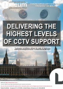
- Viseum UK delivers the world’s only all-in-one, end-to-end and integrated software systems. It optimises all new and existing legacy cameras. It also optimises all security devices and security management processes.
Surveillance Training Attendees
The number of people attending our Surveillance Training will depend on our initial research for delivering project success. For example, we will need to understand the operational processes, staff working hours/shift patterns, and existing skillsets. We place no limit on the number of people you train.
World’s Most Experienced Video Surveillance Accreditation
Viseum changes what security, surveillance and video analytics can do. Viseum’s training standards ensure its centre of excellence in London reaches every regional centre worldwide. The package educates experienced professionals in the unique benefits of their new Viseum careers.
We built this training package on an intellectually rigorous methodology, so every objective stays measurable. Our instructors teach and test every trainee to a professional standard. In effect, on completion of the course and passing of performance goals, the trainee will be certified and accredited.
Viseum UK will evaluate external training delivery and the performance of certified distributors and integrators. Equally, should this performance fall below the standards expected, Viseum reserves the right to insist upon remedial training or process rectification.
 Public safety regulations for surveillance now hold governments to account for the cameras they buy and the results they deliver.
Learn More »
Security Processes and Surveillance Training Overview
Our London surveillance operator training helps security teams run stronger operational security with far fewer operators than any other technical system needs. Security staff and emergency services have instantaneous situational awareness and decision support. The judiciary receives a continuous, unbroken and irrefutable thread of video evidence. Our holistically integrated surveillance systems outperform any other crime reduction initiative. In short, we deliver the strongest possible deterrent and the most effective video surveillance cameras: they find, fix and follow incidents. Finally, we protect the assets, property, staff and customers of any size of public or commercial activity.
Viseum’s formal training normally accompanies all major project deliveries (600+ cameras).
Customised Video Surveillance Accreditation Training Courses
Viseum CiVMS iVOS
- F3: Person Tracking.
- Face Recognition Software Technology Services: Person ID Confirmation.
- ANPR: Automated Vehicle Number Plate Recognition.
The large number of uses of Viseum’s iVOS F3 functionality, operating with Face Recognition Software Technology Services and/or iVOS ANPR, makes it impractical to provide a full training package for each application. We customise these training packages for each end user’s security project requirements. In practice, we tailor technical support manuals to suit each partner’s technical knowledge and desired capabilities.
Video Surveillance Accreditation Training Results
Viseum Certified Surveillance Training will deliver the most advanced surveillance capability. With remote video monitoring software, this will produce the fastest and most accurate complete end-to-end security service. Viseum’s intelligent cameras provide constantly vigilant surveillance for the protected remote site 24/7/365. They also uniquely produce close-up video of the incident. Each incident is reported with enough detail for the most efficient response.
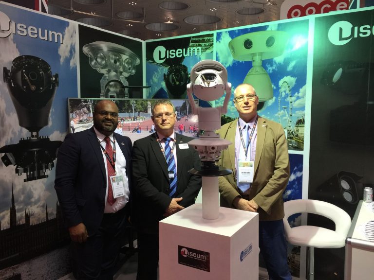 Viseum’s first TV endorsement came on BBC1’s The Politics Show. Our continued publicised success in solving the problem of wide-area security for all types of town and city regeneration projects has attracted European TV coverage.
Learn More »
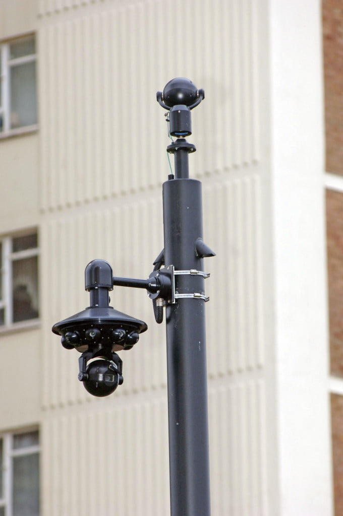 Every surveillance camera installation we deliver follows one internationally regulated process. First, we survey the site and agree measurable security goals.
Learn More »
Downloads for Viseum surveillance training London:
Training for certified partners
This training package is designed for our certified partners’ training and distribution activities. It also supports the growth of the Viseum network within their own region.
Certified partners and end users leave with the same evidence and the same standards. The training results optimise the whole project.
- Training begins with Viseum Face Recognition: Person ID Confirmation.
Explore Viseum
Viseum Technology Credentials

What happens after you contact Viseum
A specialist reads your project questionnaire for a commercial review and checks it against projects we have already delivered.
We arrange a live demonstration, either online from your own desk or on your site with a Rapid Deployment trailer.